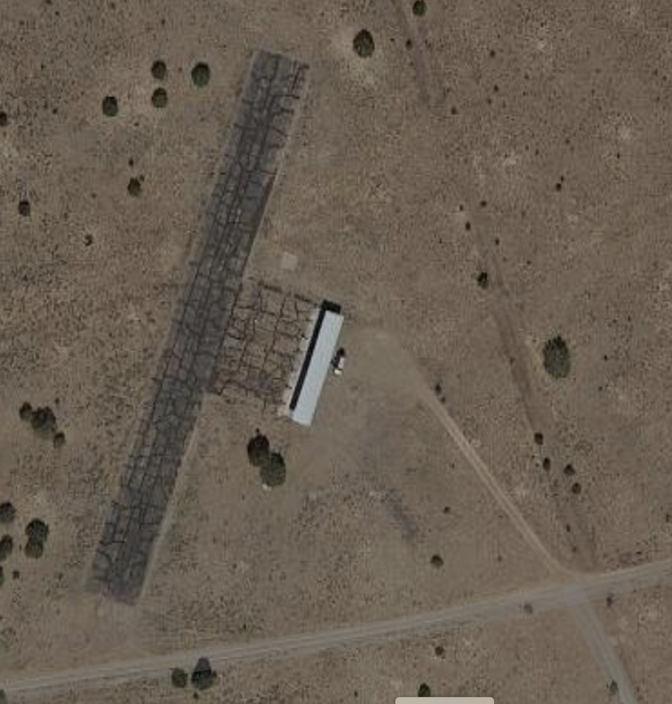
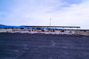
Club Field (Paved Runway)

Click here for field weather
Our club field is on land purchased by the club from the Bureau of Land Management. We have a 500 ft. paved runway with a shaded pit area and a heli pad. Directions below.
MRC (Grass Soccer Field)
Flying at the club field or the SF Municipal Recreation Complex (MRC) under the club’s permit is limited to club members and their accompanied guests. To join the club you must be a member of the Academy of Model Aeronautics (AMA).
Flying at the MRC is at the soccer field, when it is unoccupied. In addition to an FAA registration number on your aircraft, a certificate of completion of the TRUST test, and a LAANC clearance, you will need a Remote ID when they are available or after March 16, 2024 to fly at the MRC.
GPS Coordinates: 35.668471, -106.061493
Click here for field weather
FAA Regulations
Please note that the FAA regulations have changed and you need to use the LAANC – Low Altitude Authorization and Notification Capability each time you fly at the club field in addition to having a certificate of completion of the TRUST safety test and a FAA registration number on your plane. The club field has FRIA status so you won’t need a Remote ID unit to fly there. Click here for details.
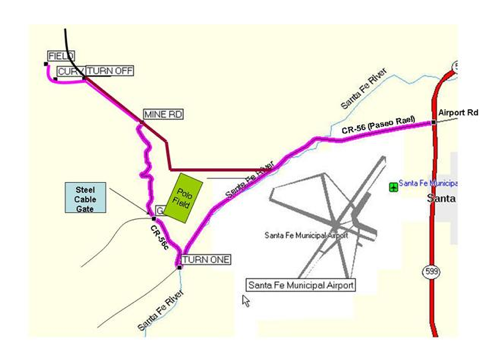
Club Field Directions
From Santa Fe:
Follow Airport Road south. Cross over 599 (Veterans Memorial Highway) at which point the road turns into CR-56 (Paseo Real).
Continue on CR-56 for about 3.5 miles. Turn right onto CR-56C, a dirt road. Continue on CR-56C over the cattle guard. The entrance to our private dirt road is on the right just past the cattle guard. You will need to unlock the cable and proceed through the gate. Follow the winding dirt road for about 1.1 miles until you terminate on a wide, red gravel mine road, and turn left. Follow the red gravel road for 0.8 miles. Look for a small red sign pointing to the left, and follow the two track dirt road until it dead-ends at our field.
From Albuquerque:
Exit I-25 northbound at Exit 276A, then turn left to follow 599 (Veterans Memorial Highway) northbound. At Airport Road/CR-56, turn left and follow directions above.